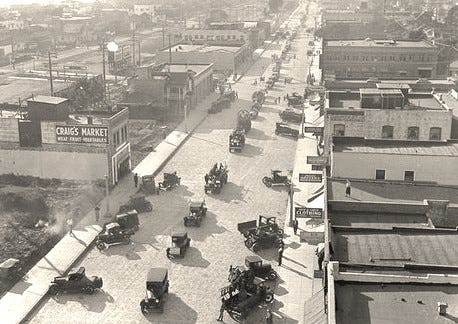
All of the buildings (227 properties) on the west side of Main St, from Hollister south to the City limits (3,000 feet), are demolished in 1926 to allow the widening of Main Street to 80 feet. If you see an old building on the west side of Main St, you can be fairly certain that it was built in 1926 or 1927.1
Ocean Park’s street layout results from the somewhat uncoordinated subdivisions of the Lucas Ranch. Main Street has its origins as Lucas Ave in 1887; which is renamed So. 2nd St in 1895, and then Main St in 1905.
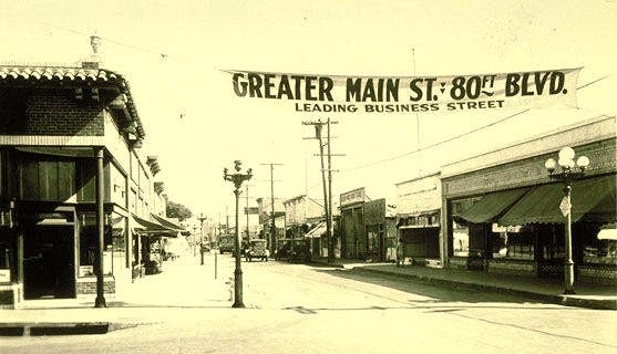
In 1926, Main St, from Pico to Hollister, is 80 ft wide (property line to property line). From Hollister to Hill, the width is 50 ft; from Hill to Pier, 45 ft; and from Pier to the City south limits, 40 ft.
The need to widen Main St has long been discussed. An enabling factor is the vacant former Santa Fe Railroad2 right-of-way that is parallel to and west of Main St.3 In 1915, Mayor T.H. Dudley appoints a committee to come up with plans to widen Main St.
While there is widespread support, the question is how to pay for it - or more pointedly who is to pay for it. In 1922, a $1.20 MM street bond election, in a spirited campaign, fails to get the required 2/3rd majority.4
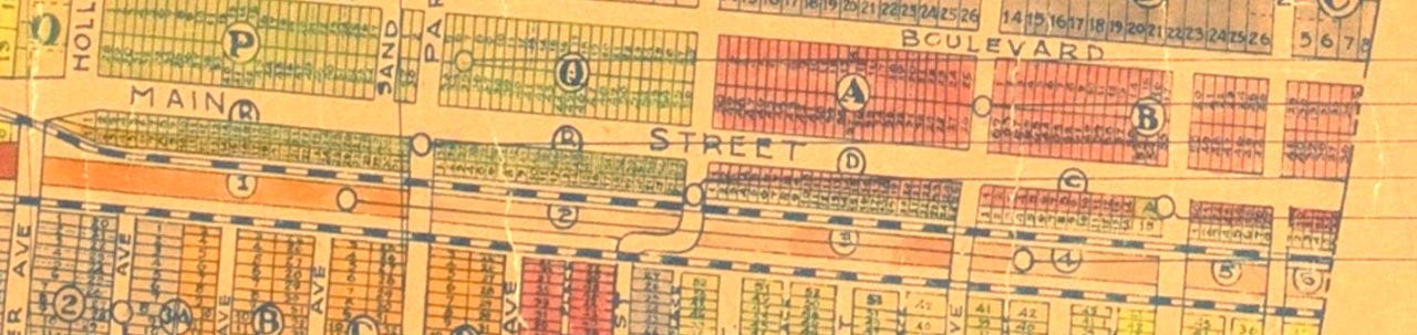
In 1923, the City Council5 adopts an ordinance to widen Main St to 80 ft6 and create an assessment district to pay for it. The plan calls for the City to
condemn the properties on the west side of Main St from Hollister to the City’s south limits;
buy a 40ft wide strip of the railroad right-of-way behind Main St; and then
sell that railroad property back to the Main St property owners to make them whole.
The result is the typical revised property map (with ghost markings of the old property lines) below.
In 1924, the assessment district property owners raise $129,000 - “Ocean Park People Buy Own Street” - Evening Vanguard, 11 July 1924. Actually, the money assessed is only the cost of acquiring the railroad property - and is only 1/4 of the estimated total cost ($450,000) of the widening project. It seems that taxpayers city wide are to make up the difference.
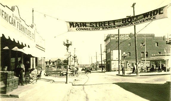
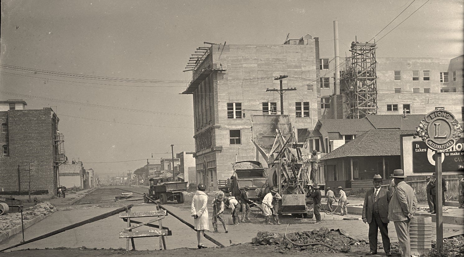
The work begins in 1925 and the opening celebration is June 1927.7,8,9
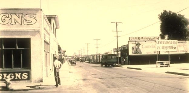
While the widening proceeds efficiently to plan, the re-building is a disappointment. There had been hopes (and announcements made) of new 2- and 3-story residential over retail brick buildings. The 3-story Shearon Building is re-built; and the existing Craig’s Market and Virgina Apartments 2-story buildings are moved back 40 feet to the new building line; and the 2-story Parkhurst Building is a promising start. However, the remainder of the new buildings are modest 1-story brick stores. Soon the Depression puts the brakes on further rebuilding. Up till the mid-1970s, from Hollister to Hill, there are only four 1-story buildings on the west side of Main St.
The next project of comparable impact on Ocean Park will be the 1960s Ocean Park Redevelopment Project.
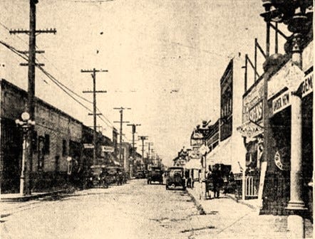
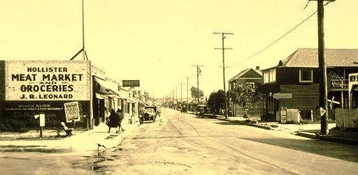
When looking at old (pre-1926) photographs of Main St, the power / telephone poles are on the west side of the street. The merchants wanted them undergrounded as part of the street widening but the utility companies said this was too expensive. The poles are moved to the right of way behind the new buildings.
The rails of the Ocean Park Loop line down Main St from Pico to Hill are removed in 1910.
For simplification, we are using “Santa Fe Railroad” to include Santa Fe and all of its subsidiary companies.
The Santa Fe Rail Road right-of-way dates from an 1891 donation of land by Kinney & Ryan. Santa Fe sells the right-of-way to Los Angeles Pacific Railway Co (LAP) in 1902. The Venice Short Line opens on Trolley Way in 1902.
Some consideration is given to not widening Main St, but instead, putting vehicular traffic on a new road along the railroad right-of-way (this is the solution later used for Trolley Way / Neilson). Moving traffic off of Main St is not favored by Main St businesses.
To make the street bond issue more appealing citywide, some north side Santa Monica street improvements are added. In the end, there are 27 items, and the bill adds up to $1.20 MM. The citywide vote is 3,076 for and 1,696 against the bond issue. It falls 150 votes short of the required 2/3rds majority.
From 1915 to 1946, the City Council consists of three elected Commissioners - one responsible for each department: Public Safety, Public Works and Finance. The Commissioner of Public Safety is the ex officio Mayor.
The street is widened to 80 ft - property line to property line. With 10 ft wide sidewalks on either side, this leaves 60 ft wide roadway.
As part of the widening project, a new sewer trunkline, sending sewage south, is installed under the widened Main St.
The 1926 widening also extends Pier Ave east across Main to 2nd St to allow street frontage and parking access for the 1926 Elks BPOE club.
One of the arguments against widening Main St is what will happen at the Venice border? Up to 1926, Venice is a separate city and cannot afford to widen the street. It is not until 1937 that the widening of Main St is extended into Venice - now absorbed by the City of Los Angeles.